

Geography and Map
Geography and Map
Pathanapuram Grama Panchayat • Kollam District
🌿 Geography
Nature • Landscape • Water Resources • Agricultural Wealth
Pathanapuram Grama Panchayat
Pathanapuram Grama Panchayat is a naturally beautiful and agriculturally rich local body in Kollam District. The Panchayat is characterised by its diverse landscape, water resources and agricultural activities.
🌳 Natural Features
Major natural resources and geographical features
⛰️ Hills and Elevated Areas
Different parts of the Panchayat include hills, small hillocks and elevated areas. These geographical features contribute to the natural beauty of the region and support agricultural activities.
🌾 Agricultural Wealth
The favourable landscape and climatic conditions support a variety of agricultural crops and contribute to the agricultural richness of Pathanapuram.
💧 Water Resources
Streams, ponds and other water sources form important components of the local water resources. Water conservation and sustainable water management are important areas of development.
📍 Geographical Details
Landscape of Pathanapuram Grama Panchayat
Covering approximately 26.28 square kilometres, Pathanapuram Grama Panchayat has a diverse geographical landscape. Hills, slopes, low-lying areas, plains and various water sources form important features of the Panchayat.
The life of the local community is closely connected with nature and agriculture. The geographical features of the Panchayat provide opportunities for natural resource conservation, agricultural development, water conservation and environmentally sustainable development.
🗺️ Map
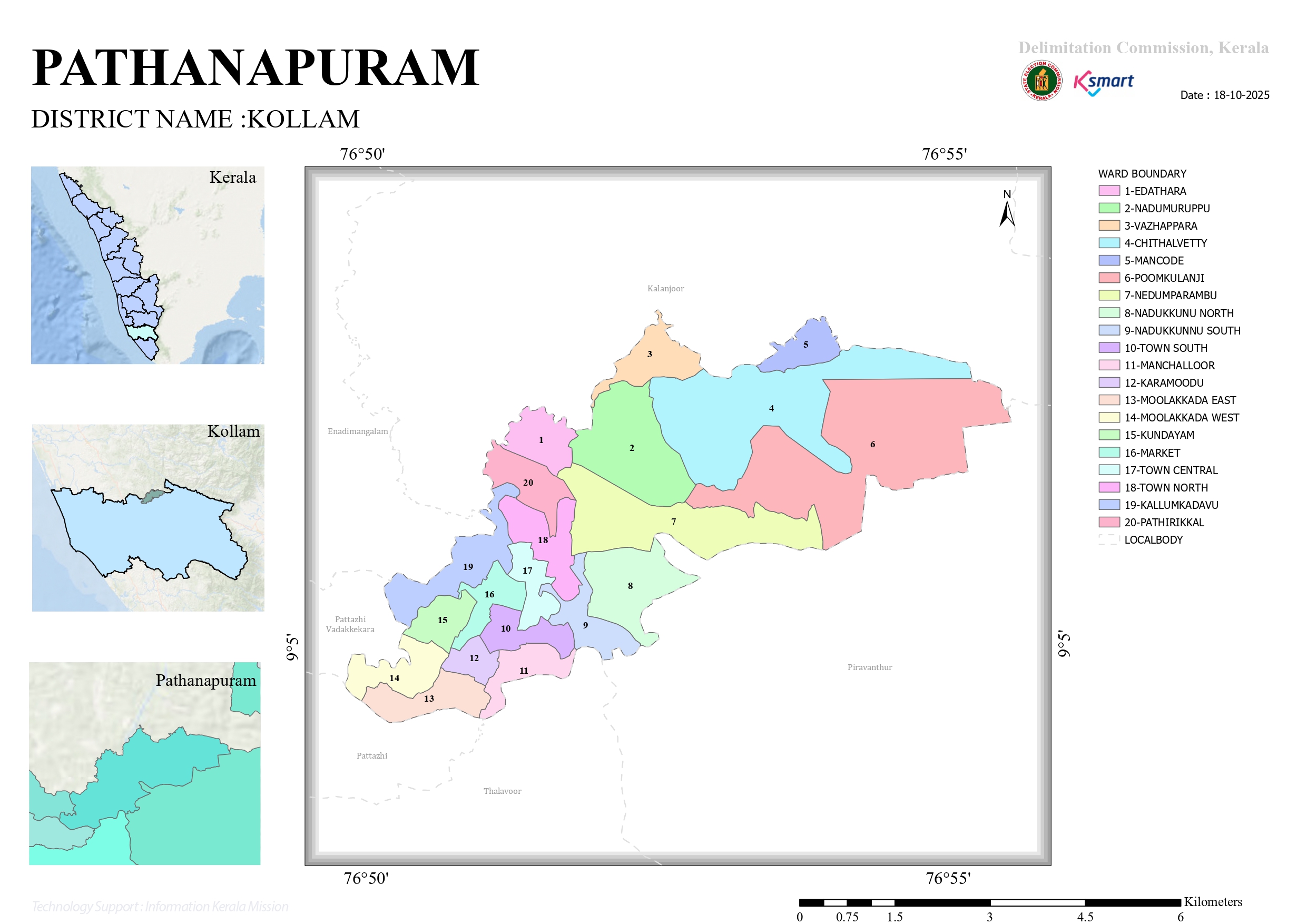
Official Map of Pathanapuram Grama Panchayat
🗺️ Pathanapuram Grama Panchayat Map
The official map of Pathanapuram Grama Panchayat is displayed below.
🏛️ Administrative Location
Administrative details of Pathanapuram Grama Panchayat
📍 Google Maps
Select the button below to view the location of Pathanapuram Grama Panchayat on Google Maps.


